- Published on
Mt. Whitney vs. AMS-Afflicted Grass-Avoidant CS Major
- Authors
- Name
- Justin Ji
What is Mt. Whitney?
Per Wikipedia:
Mount Whitney (Paiute: Tumanguya) is a mountain in California's Sierra Nevada range, and is the highest point in the contiguous United States, with an elevation of 14,505 feet (4,421 m).
Basically: big tall mountain. Also, it looks cool!
Why is Mt. Whitney?
Uhh, I just wanted to climb a big mountain. Yeah.
More in-depth: I am graduating high school, and am sort of leaving my Boy Scout troop at this point. Me, two other Eagle Scouts from my troop, another friend from our troop, and two parents wanted to hike Mt. Whitney, and we Eagle scouts wanted to send off our Scouting journeys with a bang. And well, Whitney is the tallest mountain in the lower 48! (And I know that, unless I become an absolute athletic demon, Denali is NOT happening!)
Permits
Before your hike even starts, you need a permit. Note that permit season lasts from May to October. If you plan on doing it in the winter, that's a separate story.
There are two types of permits: backpacking and day-hiking permits. Both of them can be found here. I don't really know how they'd verify you're using the correct permit, but they weren't checking permits when we went up anyways. Regardless, you should get yourself a permit!
Day-hiking permits are considerably easier to get, but backpacking is a lot more fun (in my opinion). Also, when filling out the permit lottery, you should fill out as many alternative dates as possible. This is because the lottery system essentially uses the following algorithm:
while available_hikers and available_permits:
	cur = random permit applicant
	for date_range in options:
		if has_availability:
			assign permit arbitrarily
			break

	remove cur from available_hikers
Note that this means that, if you are using date ranges in the lotttery functionality, you should probably add some degree of granularity (i.e., show some preference for weekend versus weekdays, or something like that).
Itinerary
We had a backpacking permit, with an entry date of August 5th (Wednesday). We chose the following itinerary:
- August 4: Drive to Whitney Portal, and acclimitize
- This is mainly because San Jose to Whitney Portal is a 7 hour drive...
- August 5: Hike to Consultation Lake
- 6.1 miles / 4000 ft. elevation gain
- Consultation Lake is a much nicer campsite than Trail Camp! Further details below.
- August 6: Summit Day!
- 9.5 miles / 2.6k ft. elevation gain
- This is done with a daypack, not your big backpack.
- August 7: Return to Whitney Portal
- Whitney Portal store has a restaurant with absurd portions. Go try it!
Training
So, everyone online has a billion pieces of advice to train for Mt. Whitney. I won't repeat all of them, since that's way too much work. Here's what I did, though I wouldn't recommend it:
- Do a few practice hikes at Rancho San Antonio, spamming this trail. Put a 30 lb. pack on for each training.
Yeah. Not a very thorough regimen, and certainly not a very complete one. This notably lacks the following, that most people seem to recommend:
- Any form of altitude training! (Foreshadowing, I guess.)
- Extended cardio
- Doing an actual backpacking trip
If I didn't have any outdoors experience whatsoever, then I probably would have been absolutely cooked. But I had a reasonable amount of experience with the outdoors, doing the following:
- Hiked Half Dome
- Did a 12 day backpacking trip (Philmont)
- Did a 3 day backpacking (Yosemite)
- Have camped for like, 90 nights in total
So while I'm not an outdoorsman or a thru-hiker, I have some experience. I also have reasonable cardio and leg strength, so I wasn't too concerned about the raw stats of the hike.
For a backpacker, if you have experience backpacking with large elevation gains, then you'll probably be fine TBH. However, if you're day hiking, you should really train up, since that's allegedly a ~15 hour trip with an obscene amount of elevation gain, coupled with the altitude.
Packing
This varies a lot for day hikers, though I can't imagine it being overly complicated.
Any lightweight/ultralight backpacking setup will probably suffice, as long as you're prepared for the cold and wind. The temperature can get down to 40 °F, and it is pretty windy.
My setup is linked here. It's not perfect, but was good enough for this trip.
Additional Considerations
Whitney has a few quirks that you should know about, compared to your typical hike.
1. The Wag Bags
So, here's the thing. Whitney is all rock. Human waste doesn't really decompose well in rock. Ya see where I'm going?
Leave no trace! So you need to poop in a bag. And pack it up with you. Most people will only need one bag for a backpacking trip, but I had a friend who used, like, 3 of them. It really depends on you as a person.
2. The Altitude
High altitude can cause Acute Mountain Sickness. Basically, at altitude, there isn't as much oxygen, which messes with your body. It usually starts at 8k feet, and usually starts getting problematic at around 12k.
To remedy this, you should:
- Try to acclimate for a day or two beforehand
- The general advice is to exert yourself at altitude, and then sleep at a lower altitude. But I think most people are probably fine just sleeping at Whitney Portal for a night or two beforehand. Out of 6 people in my crew, I was the only one to get screwed over by AMS
- Take ibuprofen and Diamox as preventatives
- Okay, these two medications serve different purposes. I am not a doctor, but they seem to be useful enough.
- Sleep properly. Trust. "Do as I say, not as I do".
3. The Animals
As most backpackers probably knows, there are bears in the wilderness. To prevent bears from eating your food, you put smellable items in a bear canister.
However, in Whitney, bears are not the enemy. In fact, I would be pretty surprised if a bear wandered all the way to Consultation Lake, or Trail Camp. No, the enemy is far more insidious. It's... the marmot!
Yeah, these marmots love chewing through things to get to your food. And they're quite bold! Keep your food in a canister, so the wild marmot doesn't devour it with devious efficiency.
Trip Recap
Day 0: Journey to Whitney Portal
Since I wasn't the driver (we had 1 van, with the adults driving), this was mostly just a lot of sleeping. It was scorching hot in Bakersfield when we drove by (108 °F!), but we had AC so it's whatever.
Everyone else ate the Whitney portal burger for dinner, while I made some Buldak for myself. Neither are particularly optimal for digestion, but surely it's alright!
Day 1: Hiking to Consultation Lake
This is a pretty standard hike. The trail is well defined, and not too bad. It is fairly steep, and is a bit of a leg workout.
In many respects, the granite valley you see on the way to the top resembles Yosemite. It's not as all-encompassing as Yosemite Valley, but is certainly sublime in its own right.
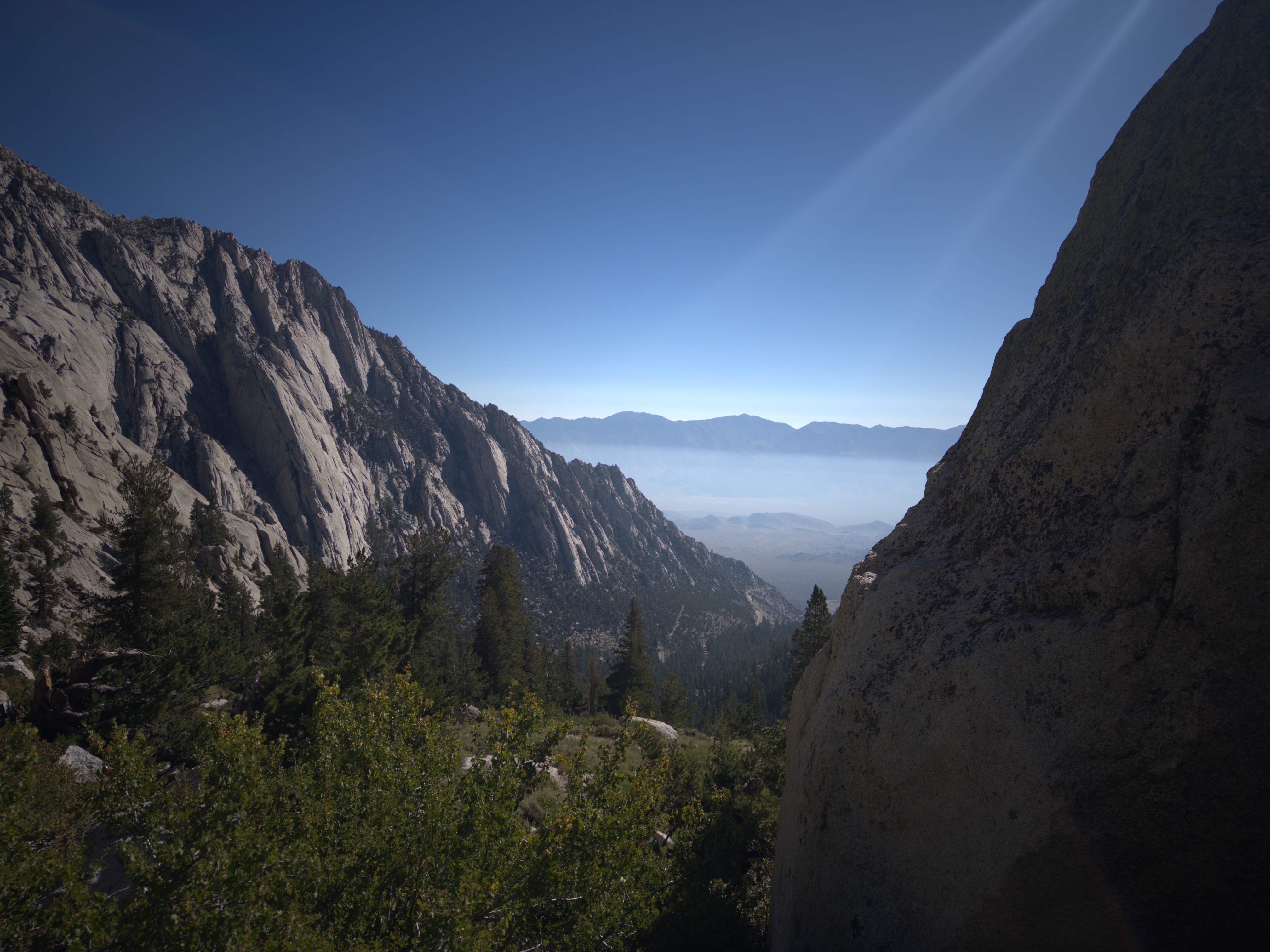
The hike is certainly strenuous, but isn't anything crazy. There is ample water on the trail, so you should be fine as long as you have water filtration (which you really should).
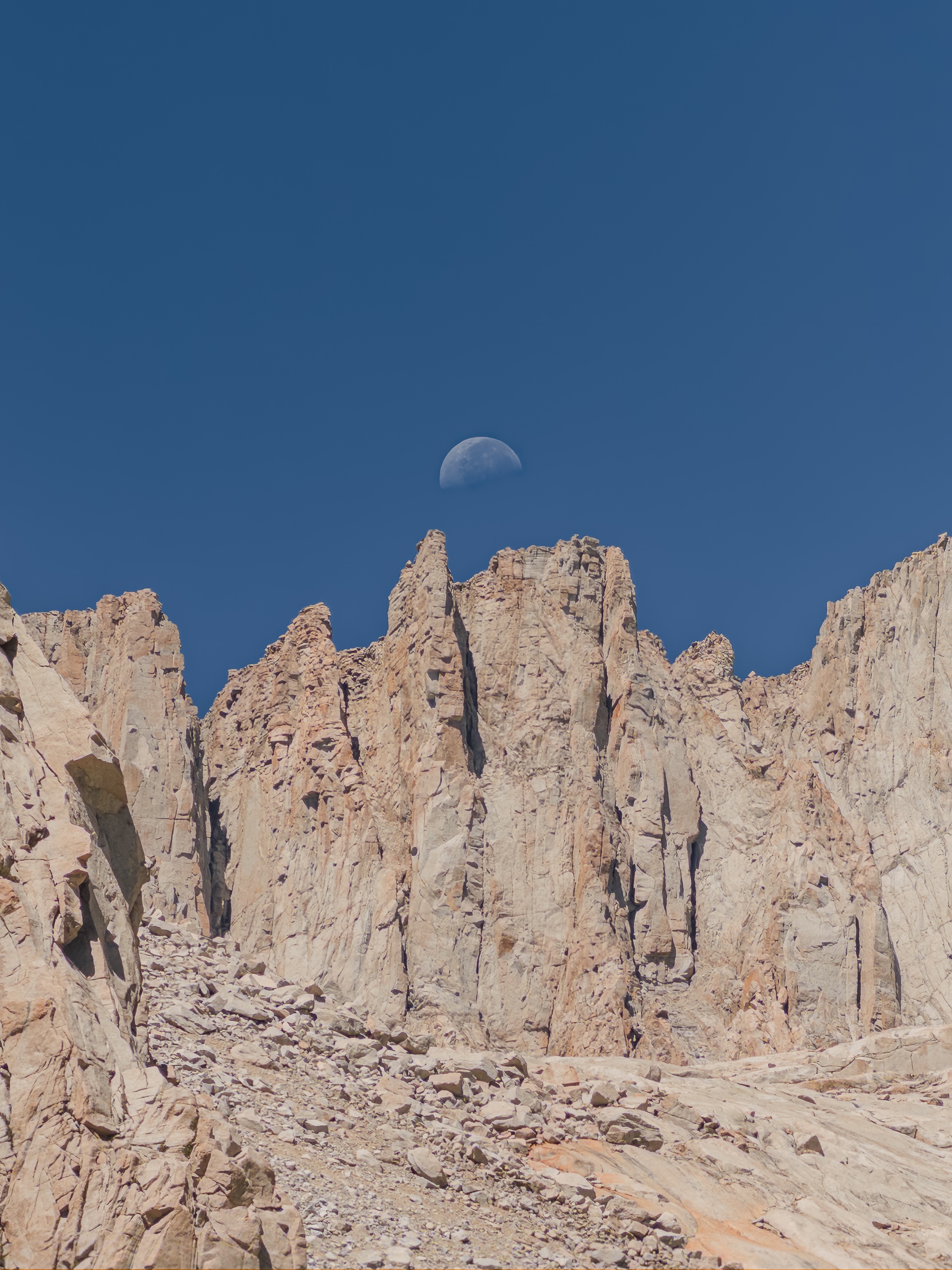
Eventually, we reached Consultation Lake. The campsite location is a bit hard to describe, but I'll try to do my best:
- If you look at the map, the site is slightly North of the center of the lake. I'll attach an image of roughly where it is.
- When hiking, you won't see Consultation Lake for the longest time. Then, you'll suddenly see the lake. This means that you're near the campsite. Try hiking along the ridge parallel to the lake, and you'll probably see the route down eventually.
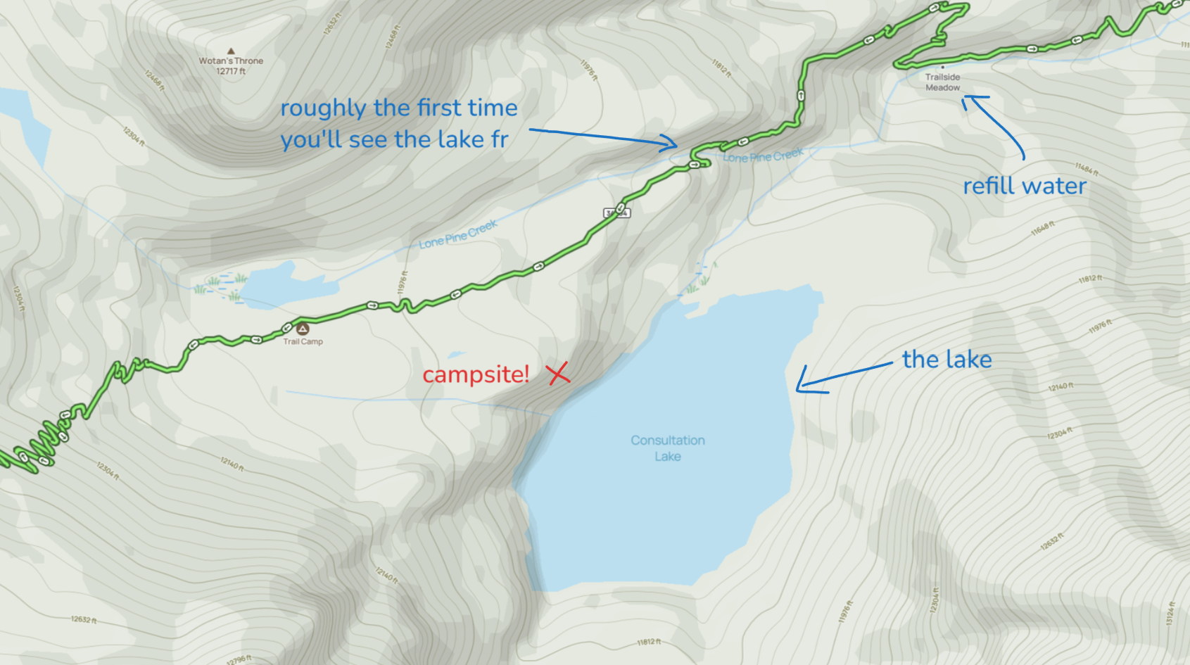
If you can't find it, then just go to Trail Camp. But it's really not that hard to find, and is much nicer than Trail Camp for the following reasons:
- There aren't 998244353 marmots trying to steal your food.
- There aren't 998244353 people around you.
- The water near Consultation Lake is fairly nice, while the Trail Camp pond is pretty gross.
- There aren't as many wag bags left around. There is trash from irresponsible hikers, but not as much as at Trail Camp.
Anyways, afterwards we camped near the lake. The view was quite pretty! But I was starting to feel a fever, and just generally felt bad. I took a nap, but that didn't help all that much.
At night, I realized that eating Buldak the night before wasn't a great idea. So I had to use the dreaded wag bags. If you don't know what those are, then just Google it. The wag-baggin' experience isn't GREAT, but it's not that bad. Like, the only bad part is taking it back, if you don't seal it correctly.
A lot of people left their wagbags at the campground. Don't be like those people. Our group opted for a bit of a grey-area approach, where we left our wag bags near our camp and tucked into some of the rocks, and packed it out when we left on day 3. This isn't what you're technically supposed to do (a.k.a. constantly keep it in the canister), but it seems like the wildlife doesn't go after wag bags anyways. (Don't take my word for this; this just seems to be anecdotally true)
Anyways, I was still feeling like crap. I took an ibuprofen, and felt better. I proceeded to sleep for a grand total of 5 hours!
Day 2: Summit Day!
To be honest, I thought that I'd have to go back to base camp the night before, due to headache, fever, and just generally feeling terrible. However, I woke up at 4 AM, and actually felt fine! So that was nice.
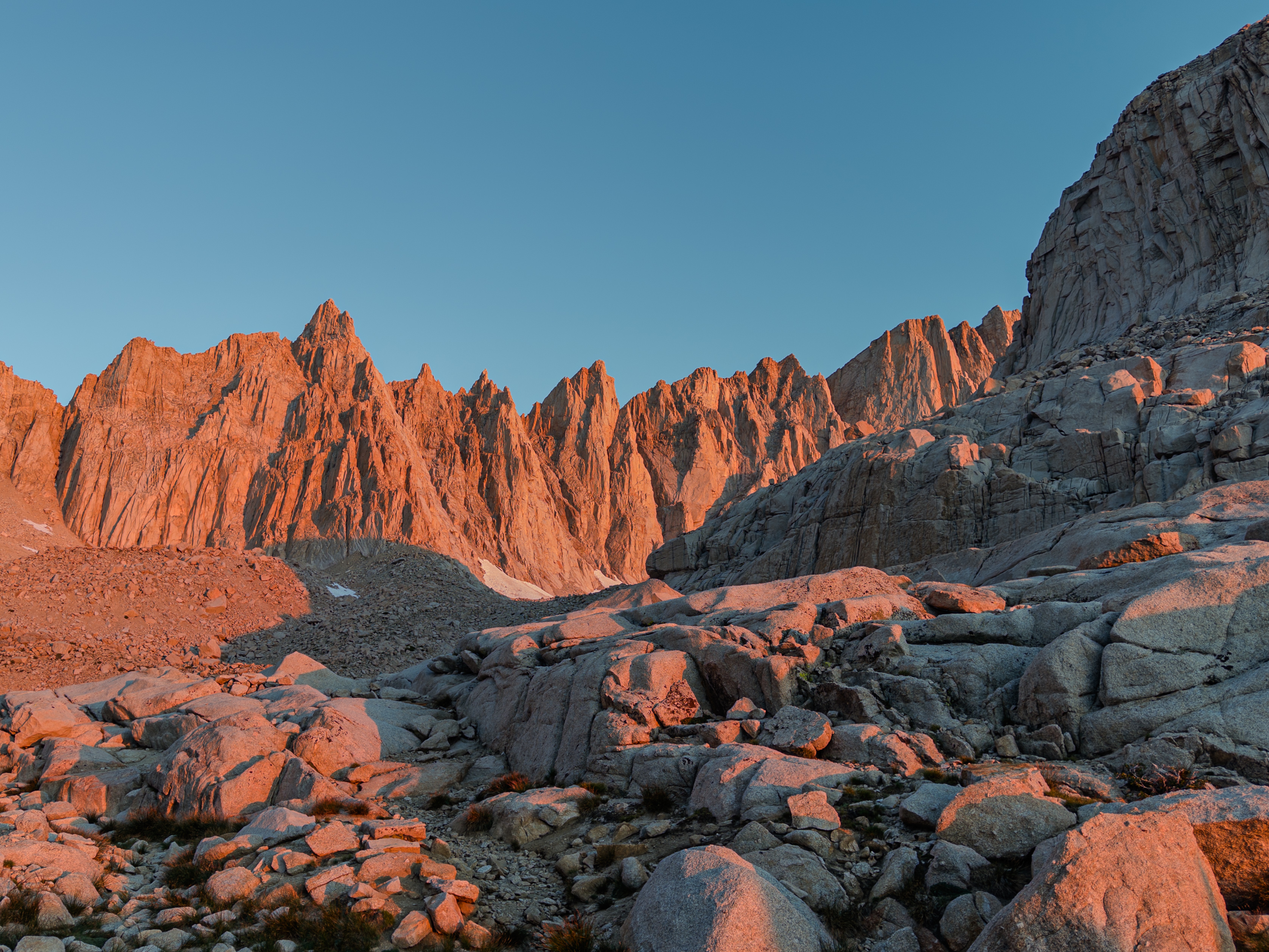
We were slow at camp, and hit the trail at 5:30. However, our pace was pretty slow, as we needed to refill water on the way up. Regardless, we made our way up the 99 Switchbacks.
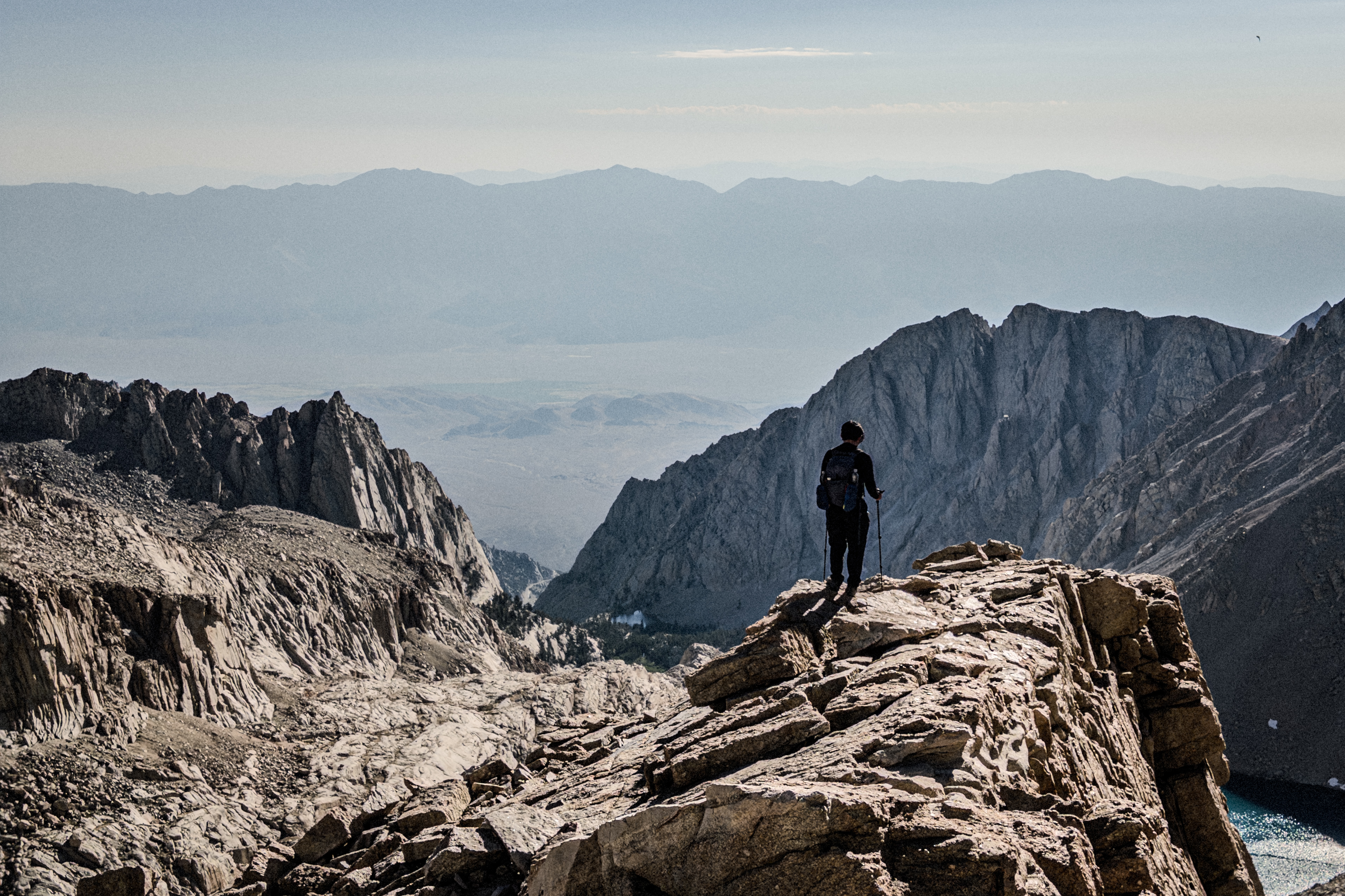
Trail Crest is probably the first time you really feel how high up you are. It also was the time where my body realized how high up I was, since I started getting a headache. Yeah, it turns out that I was probably suffering AMS the entire time, and that the ibuprofen from the night before was the sole reason I was feeling alright earlier. While I was mostly keeping up with my crew beforehand, I was moving at a snail's pace from this part of the trail onwards.
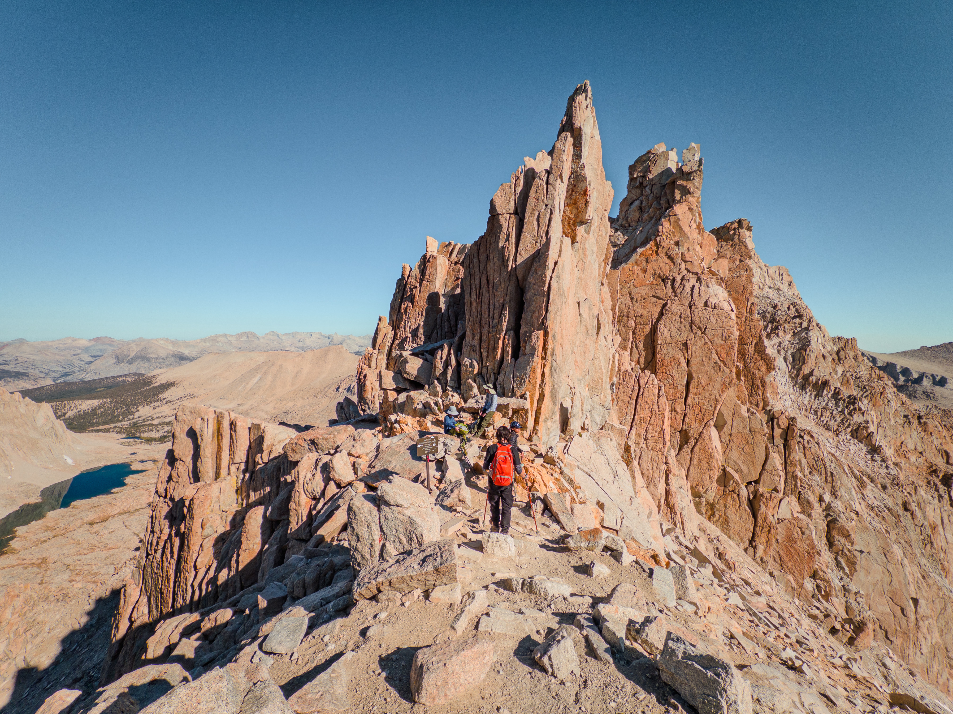
The push to the summit was just a scree field, but the trail itself was pretty clear. I just had to tough it out until the Summit.
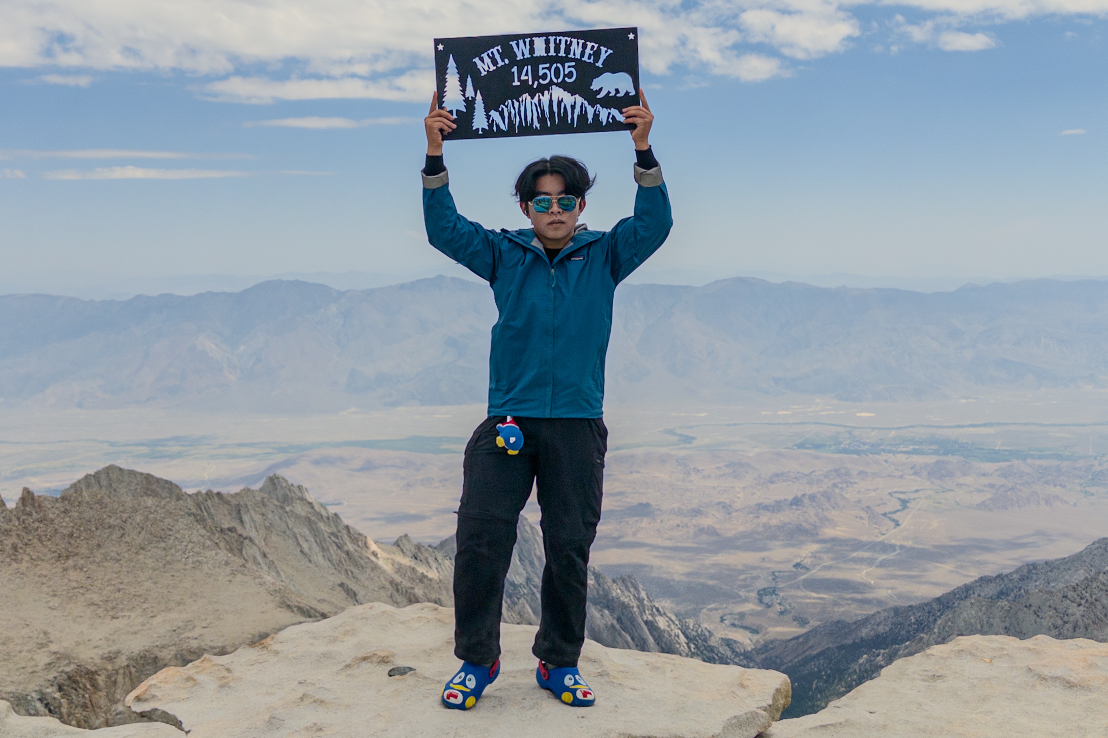
Yeah, I brought my Don Quijote crocs all the way to the top. Probably the dumbest thing I've done all year, but it was worth it for the funnies. They weigh a similar amount to my regular camp shoes anyways.
I finally realized that I was probably suffering from AMS, and took an ibuprofen. I still felt like crap for the next few hours on the descent, but was feeling a lot better at camp.
At night, the visibility was excellent -- I think this is a Bortles 1 or 2 area, so it's pretty good for astrophotography. I saw a few videos online about iOS's 30s long exposure mode, so I mounted my phone on my Insta360 and tried it out.
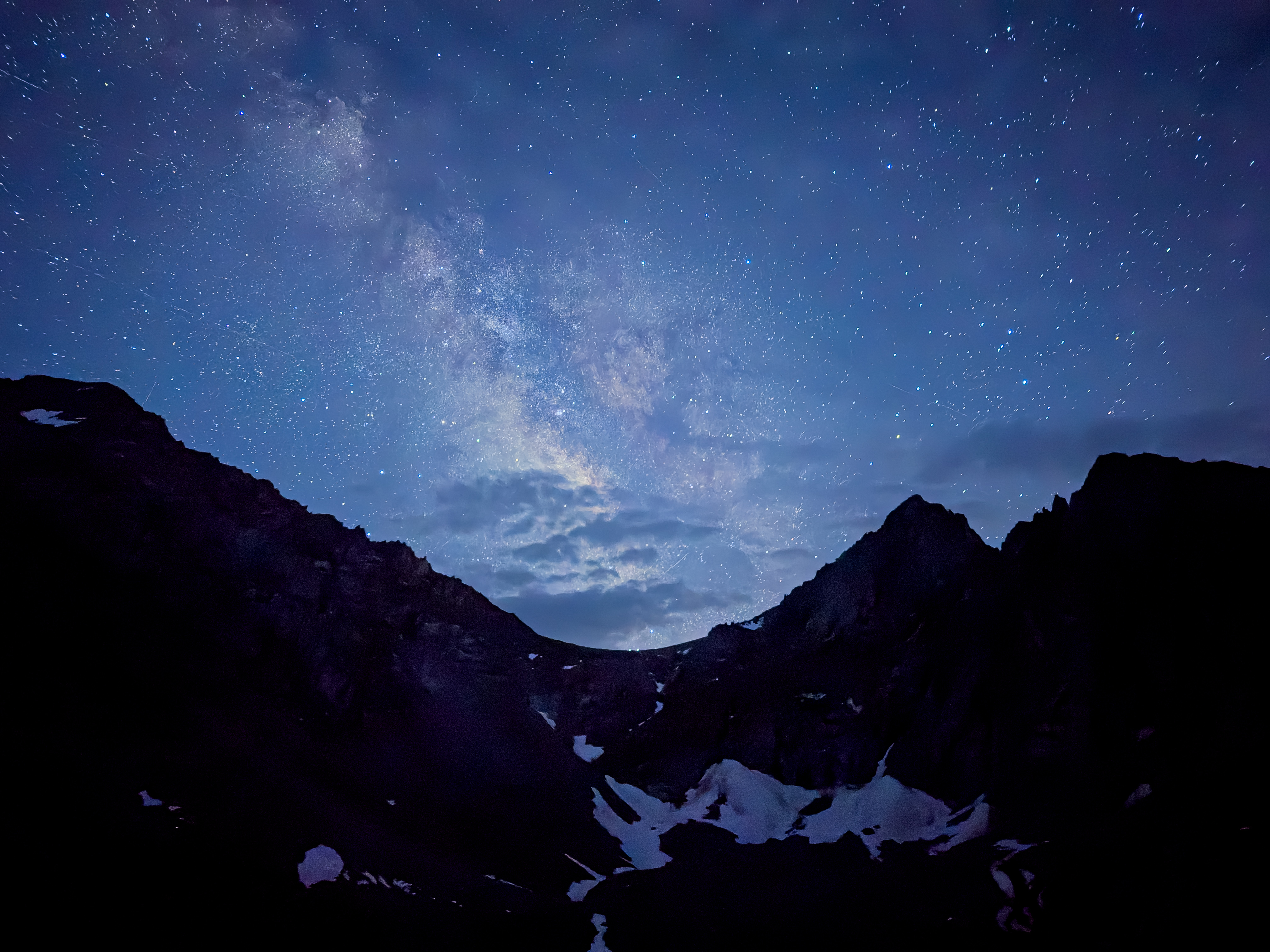
My phone did not disappoint! Messing around with some astrophotography was definitely worth the 30 minutes of lost sleep.
Day 3: The Return!
Woke up at 5 AM, saw the sunrise, and immediately knew it was time to LARP (a.k.a. take pictures).
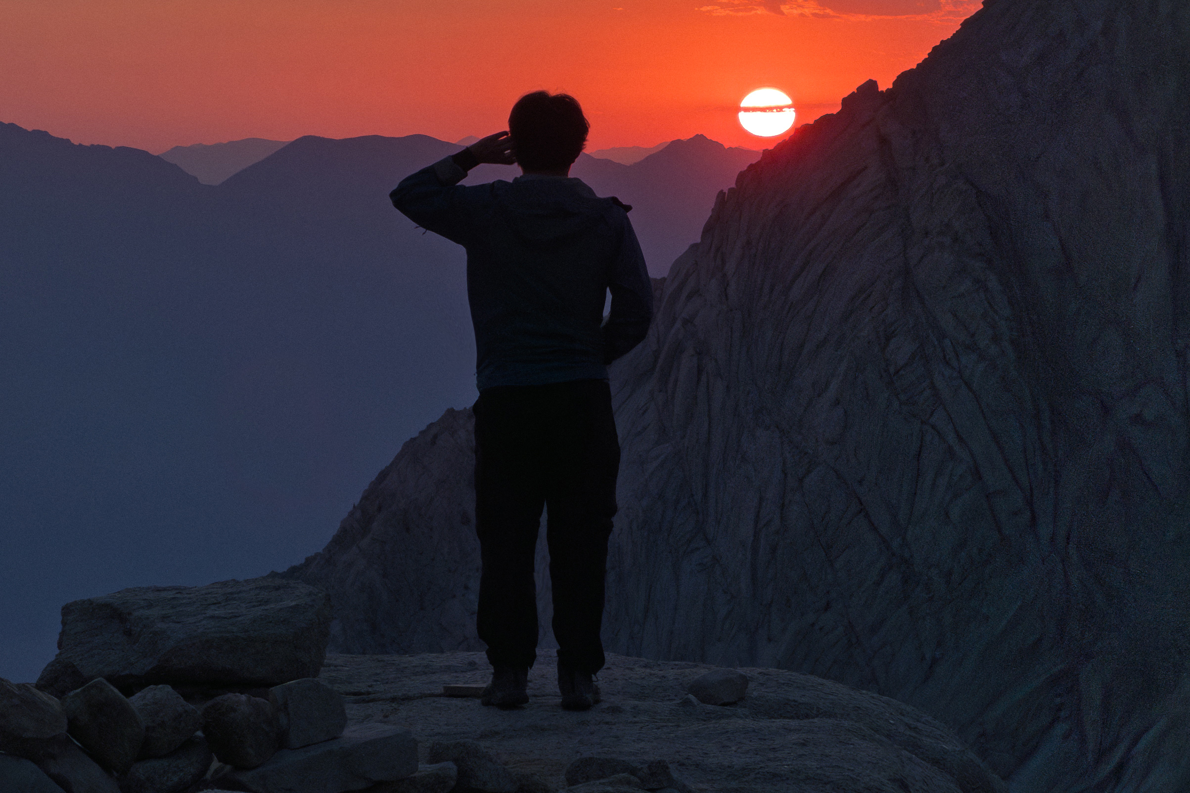
Not sure how I've never seen a sunrise like this before, since I've spent a significant amount of time outdoors. I think it's really the alpine environment, and the dramatic nature of the Owens Valley, that allow for the sunrise to look crazy.
Anyways, this part is just a fast-forward of hiking down 4000 feet. The wag bags were... not enjoyable to transport. But it could have been worse. Afterwards, we headed to the Whitney Portal store to grab food.
Our group split up, so a few of us had already gotten breakfast at the portal store. One of my friends got their $8 pancake, which was about ~1.5 ft. in diameter. He actually managed to finish it, but certainly didn't enjoy the process.
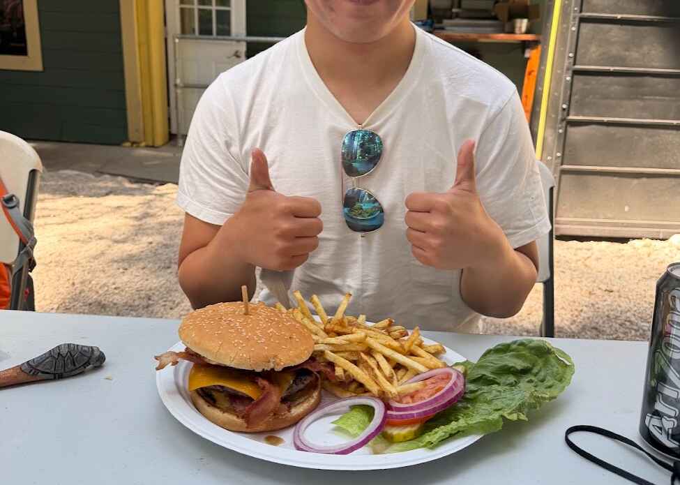
Meanwhile, I enjoyed a hearty cheeseburger. However, the Biscuits and Gravy Mountain House (BTW, this flavor sucks) filled me up more than I anticipated, so I couldn't finish it. Unfortunate.
Then it was just a 7 hour drive back to the Bay.
Recommendations
This is just some loosely organized advice:
- You should probably bring ibuprofen, even if you don't think you'll suffer AMS. I previously had a pretty solid record with altitude, going up 12K and 14K peaks without issues. I think the rapid ascent definitely caused some problems this time around. If you have Diamox, that's probably better.
- Peak Refuel >> Mountain House. I don't really like Mountain House, especially after trying Peak Refuel. Peak Refuel tastes like actual food, while Mountain House often just tastes like slop. Especially the Biscuits and Gravy one -- I don't know why people on Reddit were raving about it, because the taste and the chalky feeling it left on my teeth afterwards were not desirable.
- Consultation Lake is much nicer than Trail Camp! I describe why earlier in this post.
- Pack ultralight if possible. Ditch excess clothing, unless it's for the purpose of layering. As appropriate, obviously. But it gives you more flexibility for some 'luxury' items. For me, those were my Donpen Crocs and my Insta360 gimbal.
- SmartWater bottles are much nicer than Platypus or Nalgene bottles. They're cheap, are compatible with Sawyers, and are easy to grab. If you're worried about microplastics then uhhh... maybe get a Nalgene, IDK. But the Smartwaters work pretty well.
- Make sure to heavily backflush your filter before your trip. I didn't, and was stuck with a slow filter. That was not a fun experience.
- Most people say that altitude makes you less hungry. This is true, but I still underpacked food. Luckily one of my friends brought a lot more food than needed, so I mooched off a few of his PowerCrunch bars.
- Bring hiking poles, and preferably a super tough pair of hiking boots. Unless knee surgery is tomorrow, you want to spare your kneecaps from the suffering of the downhill. Also, the trail is stupidly rocky, so your shoes will take a beating.
- If you want to take cool smartphone pics, Project Indigo is a neat app that produces photos closer to that of a DSLR/mirrorless. I used it for most of these pictures, and I like it a lot more than the stock app.
Reflections
For one, hiking Whitney reminded me of how sedentary I've been for the past year or two. Grinding college apps (and proceeding to brick them, but that's a separate story), being lazy, etc. haven't really been all that good for my hiking stamina.
I remember back in 2023 that Half Dome felt relatively easy. I had some minor muscle cramping towards the end, but the cardio part was easy. This time, it was a bit of the reverse. My legs weren't really sore at all (I guess I can thank the gym for that), but I think my heartrate was exceeding 180 for like 75% of the Summit Day. Granted, AMS was definitely messing with me, but still not great.
Overall, I enjoyed this trip, AMS and all. At UCSD, I really hope to summit a few more mountains. Hopefully I can tackle Mount San Jacinto, Baldy, and some more! We'll see, I guess.